
Jonas Sullivan · 4 November 2026
Hydrological Assessments Spotlight Flintrock Region's Aquifer Potential for Neighboring Municipalities
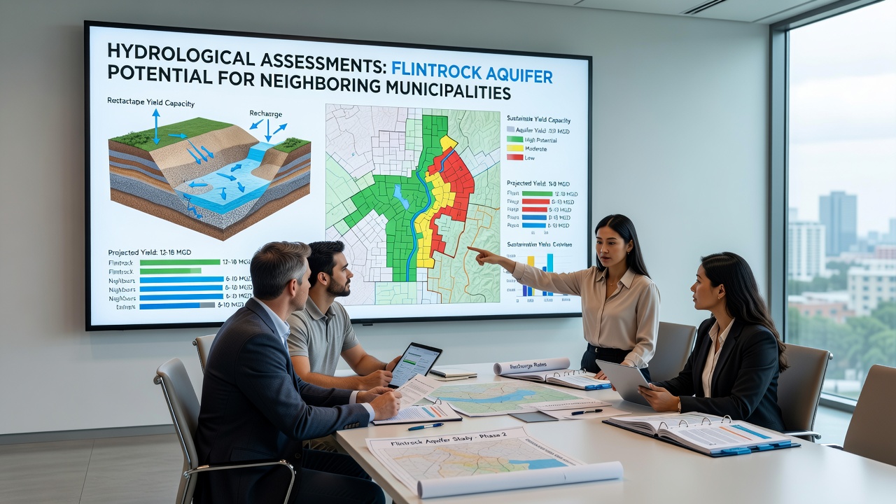
Recent hydrological assessments have mapped extensive groundwater resources beneath the Flintrock region, and these findings point to substantial aquifer capacity that could support water needs in adjacent municipalities. Data collected through seismic surveys, borehole logging, and recharge modeling shows consistent aquifer thicknesses ranging from 80 to 150 meters across key zones, while permeability tests indicate flow rates suitable for municipal-scale extraction without immediate depletion risks.
Assessment Methods and Data Collection
Teams from regional water authorities conducted fieldwork between March and September 2026, deploying electromagnetic resistivity surveys alongside traditional drilling operations to build three-dimensional models of subsurface layers. Researchers recorded hydraulic conductivity values averaging 12 meters per day in the primary sandstone formations, and they cross-referenced these readings with precipitation records spanning the past three decades. The resulting datasets reveal annual recharge estimates of approximately 45 million cubic meters, a figure that aligns with patterns observed in similar geological settings documented by the U.S. Geological Survey.
Monitoring wells installed at 24 locations provided continuous water-level measurements, and these instruments captured seasonal fluctuations that peak during spring snowmelt periods. Analysts then integrated the data into MODFLOW simulations, which project stable drawdown levels even under increased pumping scenarios of up to 20 percent above current regional baselines.
Key Findings on Aquifer Capacity
Core samples extracted during the drilling phase confirmed the presence of high-quality sandstone aquifers with low clay content, a combination that supports efficient filtration and storage. Laboratory analysis of water chemistry showed total dissolved solids below 350 milligrams per liter, meeting standards for potable use after minimal treatment. These characteristics position the Flintrock aquifer as a viable supplementary source for municipalities facing constraints from surface-water allocations.
Modeling outputs further indicate that the aquifer extends laterally into neighboring jurisdictions, creating shared resource boundaries that require coordinated management protocols. One study revealed that extraction points near the municipal borders could deliver 8,000 cubic meters daily while maintaining sustainable yield thresholds over a 50-year horizon.
Implications for Neighboring Municipalities
Officials in three adjacent towns have already requested access to the assessment reports, and preliminary discussions focus on infrastructure requirements such as transmission pipelines and treatment facilities. Projections from the models suggest that connecting to the Flintrock aquifer could offset projected shortfalls of 15 to 25 percent in municipal supplies by 2035. Engineers note that existing wellhead protection zones would need expansion to accommodate new production wells, yet the overall footprint remains smaller than equivalent surface reservoir developments.
Regional planning documents reference similar aquifer-sharing arrangements in other parts of North America, where joint commissions have successfully balanced extraction volumes with ecological safeguards. In November 2026, updated monitoring data will become available through an online portal managed by the state water resources department, allowing municipalities to review real-time levels before finalizing allocation agreements.
Regulatory and Planning Context
State statutes require environmental impact reviews prior to any large-scale withdrawals, and these evaluations must address potential effects on baseflow to nearby streams. The assessments incorporate habitat data for endemic fish species, and mitigation measures such as seasonal pumping restrictions have already been outlined in draft permits. Observers note that compliance timelines align with federal guidelines from the Environmental Protection Agency, which emphasize integrated water resource management across jurisdictional lines.
Cost estimates for shared infrastructure range from 12 to 18 million dollars, depending on pipeline routing options, while funding mechanisms under discussion include state revolving loan programs and inter-municipal cost-sharing formulas. These figures derive from engineering bids submitted in late 2025 and remain subject to final design adjustments.
Conclusion
The hydrological assessments establish a clear technical foundation for expanding the Flintrock aquifer's role in regional water supply strategies. Continued data collection through 2026 and beyond will refine yield projections and support adaptive management decisions. Municipalities now hold the information needed to evaluate integration timelines and infrastructure investments, while regulatory frameworks provide structured pathways for responsible development of the shared resource.